Napa River and Bay Trail
![]()
Activities: Hiking/Walking, Cycling, Wildlife Viewing
Location: Various locations along the river. Please see below for location and trail notes.
Hours: Sunrise to sunset.
Fees & Details: There are no fees for this trail. All trails are multi-use.
Amenities: Each location has different amenities such as parking and restrooms. Please see below for details about specific locations.
Park Rules: Dogs are allowed and must be on leash at all times. No fishing, swimming or boating in ponds. Please stay on marked sections of trail and within boundary signs.
Maps and Park Notes: Napa River Bay Trail Brochure, Napa River & Bay Trail Map, San Francisco Bay Trail Map
The Napa River and Bay Trail is a Class I (paved) pedestrian and bicycle path which will eventually connect from the southern boundary of the City of American Canyon to the northern boundary of the City of Napa. Over two-thirds of the population of Napa County lives in the area served by this trail.
Except for the section north of Imola Avenue in the City of Napa, the route is also part of the ambitious 500 mile-long region-wide San Francisco Bay Trail, now a little more than half completed.
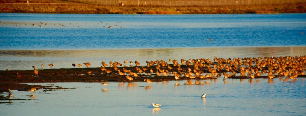
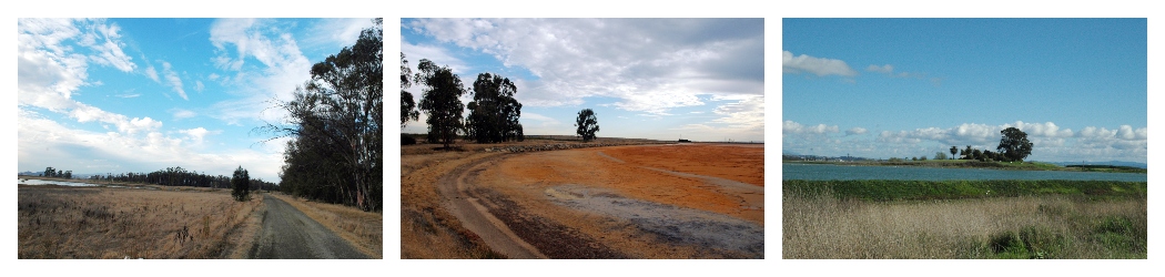
There is ongoing work on this trail network and new additions and improvements will be made over time. These trails popular with locals and visitors alike, and are a great option for a walk along the water to enjoy the bay & river and enjoy birds and other wildlife.
There are several trailheads to access this regional trail, the most heavily frequented being Wetlands Edge Park, a partnership between the Napa Open Space District and the City of American Canyon. In partnership with the city, the Napa Open Space District has constructed about 5 miles of the trail at Wetlands Edge, with just over more 4 miles remaining to be completed.
How to Access the Napa River and Bay Trail
The Napa River and Bay Trail has several different segments, all accessible to the public. Each has different amenities and parking, so please see the details below and consult a map before heading out for a walk. There are no fees at these trailheads.
Wetlands Edge Park: Parking, restrooms, (See Park Page here).
Green Island Trailhead: Parking and restrooms at the center of Dept. of Fish & Wildlife property (Google Map here).
Alternate parking may be available on Green Island Rd, but this is shoulder parking with no amenities or restrooms.
Suscol Ferry Rd: Street parking on shoulder, no restrooms (Google Map here).
The City of Napa also has several trailheads:
Kennedy Park: Parking, restrooms.
Kennedy Park to Third St: No parking or restrooms.
Lincoln Ave to Trancas St: No parking or restrooms.
History of the Wetlands
The waters, wetlands and uplands you see along the Napa River Bay Trail are part of an interconnected watershed system that drains into the San Francisco Bay. Before the 1850’s, San Francisco Bay had edges with extensive, miles-wide tidal marshes. By the 1950’s, nearly 85% of these marshlands had been diked or filled. The low-lying flood plains found in American Canyon include mudflats, tidal and seasonal wetlands, former salt ponds, riparian corridors, and lands reclaimed for agriculture and development. These “baylands” provide habitat for waterfowl, shorebirds, fish and wildlife species.
Additional Napa River and Bay Trail Information and Articles:
- San Francisco Bay Trail
- City of American Canyon Parks
- “Building the Wetlands Edge Trails” Video
- Doug McConnell Wetlands Edge video (VIZZIT App)
- Hiking the Napa River Bay Trail (Napa Valley Register, June 27, 2017)
- New trail system dedicated in American Canyon (June 4, 2012, American Canyon Eagle)
- American Canyon to name trail after Thompson (August 20, 2010, Napa Valley Register)