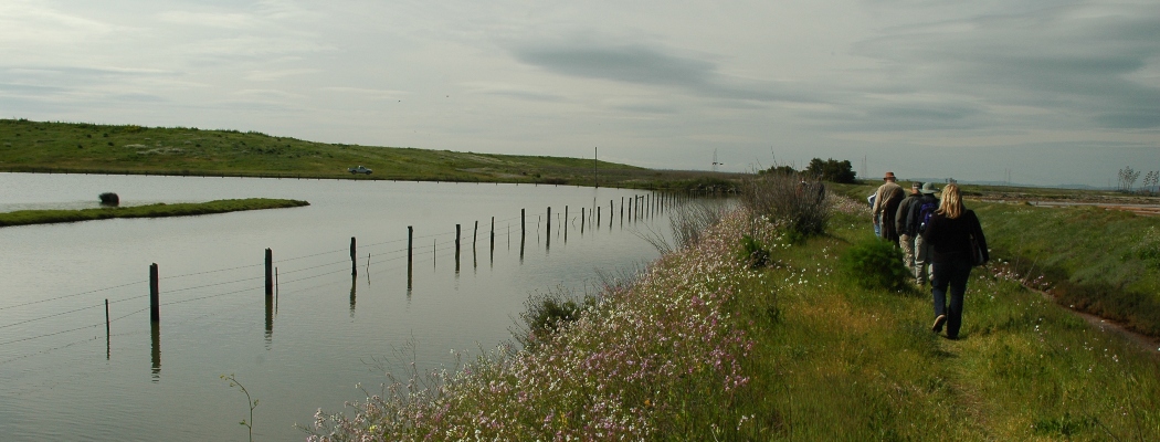
Wetlands Edge Park
Part of the Napa River and Bay Trail
![]()
Activities: Hiking/Walking, Cycling, Wildlife Viewing
Location: Main Parking Area: 2 Eucalyptus Dr, American Canyon, CA 94503 Google Map
Hours: Sunrise to sunset.
Fees & Details: There are no fees at Wetlands Edge Park. All trails are multi-use.
Amenities: Parking lot for all size vehicles, ADA portable restroom, accessible trails.
Park Rules: Dogs are allowed and must be on leash at all times. No horses permitted at this park. No alcohol, glass containers, or smoking allowed. No fishing, swimming or boating in ponds.
Maps and Park Notes: Napa River Bay Trail Brochure, City of American Canyon Parks page, Napa River & Bay Trail Map, San Francisco Bay Trail Map

Wetlands Edge Park is managed jointly by the City of American Canyon and the Napa County Regional Park & Open Space District. Following the Napa-Sonoma Marsh shore line, the trails provide a variety of ways to explore the marshland and Napa River.
The wetlands are a great place for bird watching and enjoying the sunrise or sunset, and are heavily used by locals for family outings, walks, and bike rides. There are two entrances to the trails, one at the end of Green Island Road (where there is also a kayak and canoe launch ramp and other short unimproved levee-top trails) and the other on Wetlands Edge Road and Eucalyptus Drive where there is paved parking and a restroom.

Napa River and Bay Trail & San Francisco Bay Trail
The trails in this park are a part of the Napa River and Bay Trail as well as the San Francisco Bay Trail, two regional trail systems that connect our communities.
The Napa River and Bay Trail is a paved pedestrian and bicycle path which will eventually connect from the southern boundary of the City of American Canyon to the northern boundary of the City of Napa. The trail is is also part of the ambitious 500 mile-long region-wide San Francisco Bay Trail, now a little more than half completed. In partnership with the City of American Canyon, the Napa Open Space District has constructed about 5 miles of the trail, with just over more 4 miles remaining to be completed.
History of the Wetlands
The waters, wetlands and uplands you see along the Napa River Bay Trail are part of an interconnected watershed system that drains into the San Francisco Bay. Before the 1850’s, San Francisco Bay had edges with extensive, miles-wide tidal marshes. By the 1950’s, nearly 85% of these marshlands had been diked or filled. The low-lying flood plains found in American Canyon include mudflats, tidal and seasonal wetlands, former salt ponds, riparian corridors, and lands reclaimed for agriculture and development. These “baylands” provide habitat for waterfowl, shorebirds, fish and wildlife species.
Learn more about the wetlands in the City of American Canyon Parks brochure here.
Additional Wetlands Edge Information and Articles:
- City of American Canyon Parks
- American Canyon Community & Parks Foundation
- “Building the Wetlands Edge Trails” Video
- Doug McConnell Wetlands Edge video (VIZZIT App)
- New trail system dedicated in American Canyon (June 4, 2012, American Canyon Eagle)
- American Canyon to name trail after Thompson (August 20, 2010, Napa Valley Register)
- Trail to River Opens in American Canyon (April 26, 2010, Napa Valley Register)

